

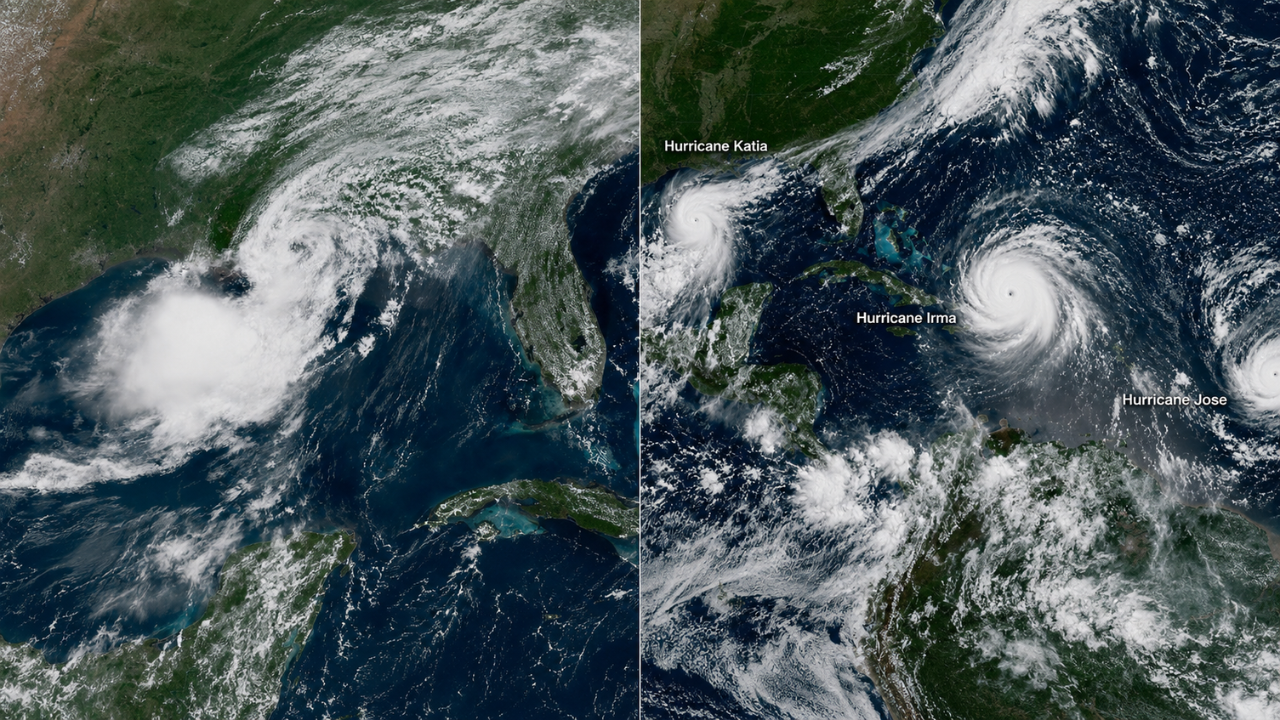
Tropical Development – Forecasters across the Atlantic basin are monitoring three separate areas for possible development as tropical activity is gaining increased attention. The activity occurs in the middle of the Atlantic hurricane season, when warm ocean temperatures and favourable atmospheric conditions can enable tropical disturbances to organise more rapidly. Residents along the U.S. East Coast, Gulf Coast, Florida and the Caribbean should continue to monitor official forecasts as meteorologists determine if any of these systems could intensify.
Transatlantic Monitoring in Three Spheres
The broader Atlantic region is now being monitored for 3 areas of disorganised weather. The fact that they’re being watched at this stage doesn’t mean any of the systems will necessarily become a tropical depression or named storm.
To determine whether a disturbance has a chance to develop, meteorologists look for things like thunderstorm organisation, surface circulation, wind shear, moisture in the atmosphere and ocean temperatures.
Especially over a period of days, conditions can change a lot, so it’s important to look for regular updates to the forecast.
Floridians are watching the tropics closely
Florida’s position between the Gulf of Mexico and western Atlantic means it often draws more attention whenever tropical disturbances form in the Atlantic.
But a disturbance far offshore doesn’t mean Florida is automatically going to be directly impacted. Confidence in the forecast of eventual tracks is generally limited until the system develops a defined circulation.
So, residents should listen to official outlooks from the National Hurricane Centre and not individual long-range model runs posted on social media.
August Brings A More Active Phase of Hurricane Season
For Atlantic hurricanes, things really start picking up through August, then peak near climatology around September 10.
At this time of year, disturbances that travel westward from Africa can interact with warm waters in the Atlantic that are capable of supporting tropical development. Systems can also develop closer to the Caribbean, Gulf of Mexico or southeastern U.S. when the atmospheric conditions become favourable.
That seasonal pattern is why meteorologists pay close attention even to poorly organised disturbances in August.
Development Doesn’t Mean a U.S. Landfall
Tropical depressions and tropical storms can form without ever threatening the continental U.S.
Ultimately it comes down to the steering currents from large-scale weather patterns that will decide if the system will curve out into the open Atlantic, go into the Caribbean, come towards the South-east or head to the Gulf.
Once a well defined centre develops, forecast tracks also become more reliable. But in the time before, small changes in the location of where a disturbance organises can lead to large differences in subsequent forecast scenarios.
National Hurricane Centre is the Key Official Source
The National Hurricane Centre issues Tropical Weather Outlooks which describe areas where tropical or subtropical development may occur.
These outlooks provide the probability of development for specific timeframes and are updated regularly when the Atlantic basin is active. More detailed advisories are issued after a tropical cyclone has formed and include information on the position, strength, forecast track, and possible risks.
Local offices of the National Weather Service then provide more detailed information to communities that might be affected.
Sources
- WFTV 9 – Tracking three areas to watch for possible tropical development in Atlantic
- National Hurricane Centre (NHC) – Official Atlantic Tropical Weather Outlooks, probabilities of development and storm advisories
- National Weather Service (NWS) – Local forecasts, tropical alerts, watches, warnings and safety guidance
- NOAA – Atlantic hurricane climatology, tropical cyclone information, seasonal data
- FEMA – Hurricane tips for preparedness, evacuation and emergency-supply