
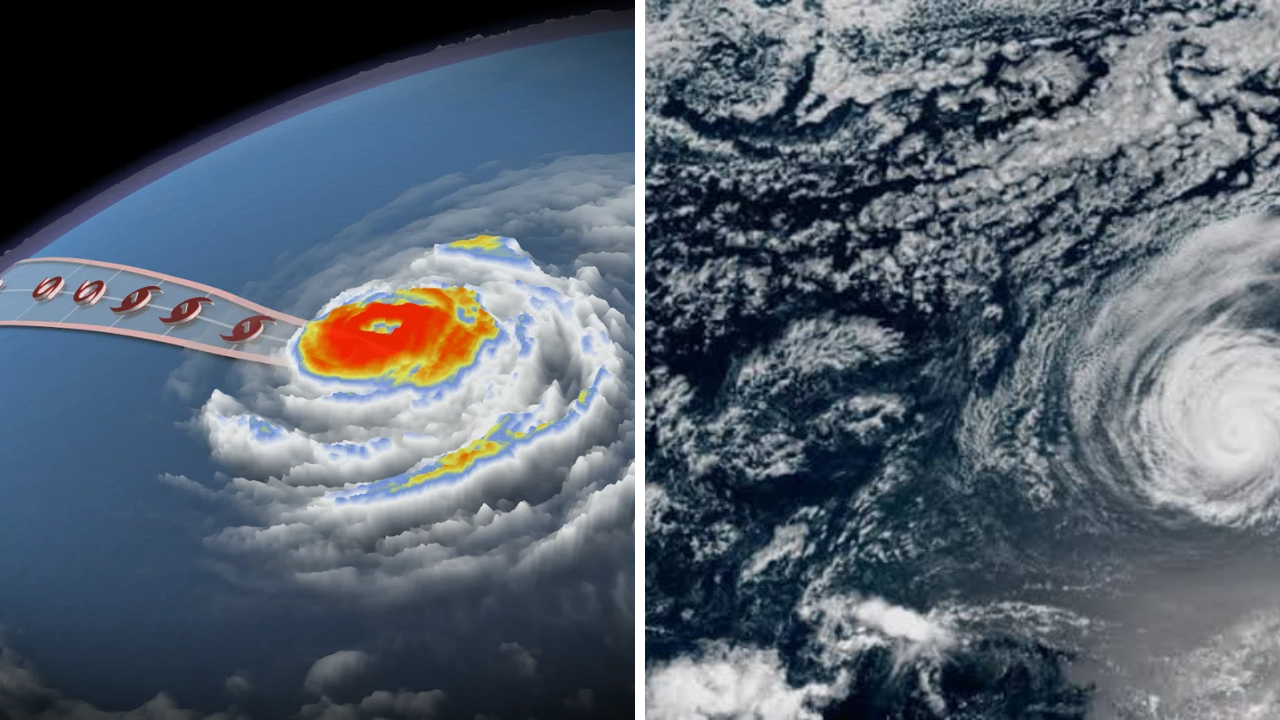
Hurricane Fausto is forecast to generate large ocean swells that may impact portions of Hawaii, increasing the threat for hazardous surf and rip currents along with strong coastal currents. Even if the storm remains far from the islands, hurricanes can generate large waves hundreds of miles across open ocean and hazardous conditions along exposed shorelines.
As updated weather maps show wave energy moving towards the island chain, the Hurricane Fausto Hawaii swell forecast should become more important. Residents, swimmers, surfers, boaters and visitors should keep an eye on official forecasts as the timing and strength of the swells may change as the storm progresses.
Hurricane Fausto May Affect Hawaii From Afar
Hawaii can face dangerous conditions even if a tropical cyclone doesn’t make landfall. Strong winds around the storm can create large waves that travel far from the storm centre.
Such waves, moving into shallower water near the coast, can increase in height and strength. This can mean rough surf, dangerous shore breaks and conditions that can change quickly on beaches that look calm.
The biggest impacts would likely be along the coastlines that face directly into the incoming swell. But the wave height can vary a lot from place to place depending on local reefs, bays and underwater terrain.
New Forecast Maps Show Swell Direction
Meteorologists use the forecast maps to estimate the distribution of wave energy across the Pacific. These maps typically show the projected path of the storm, wind field, wave heights, period of the swell and expected arrival time.
Long-period swells are particularly important because they carry more energy and can create large waves when they reach the shores of Hawaii. Offshore wave heights may seem moderate, but local conditions can become hazardous when the swell interacts with reefs and steep shorelines.
Forecast maps are updated frequently as new data from satellites, aircraft, buoys, and computer models become available. Therefore the expected effect may change with each update.
Rip Currents And Dangerous Surf Possible
Strong waves can create treacherous rip currents that can pull swimmers out to sea. Strong currents may also affect harbours, channels and areas near rocky coastlines.
Those walking on beaches or rocky coasts may be caught by waves that suddenly come much farther inland than expected. These waves can knock people over and drag them into the water.”
Authorities may issue high surf advisories, high surf warnings or small craft advisories, depending on how bad it’s expected to get. In some areas, if conditions become too dangerous, the beaches may be closed.
Surfers Need to Be Careful in These Conditions
While experienced surfers often seek out the potent hurricane-generated swells, they can also bring about unpredictable and very dangerous conditions. The size of the waves alone does not reflect the full risk.
Strong currents, shifting peaks, shallow reefs and heavy shore breaks can hinder rescue operations. Conditions may also change rapidly with the arrival of different parts of the swell.
Swimmers and surfers with limited experience should stay out of the water during warning periods. Even the most experienced surfers should check local forecasts, lifeguard notices and beach conditions before paddling out.
Rougher Seas May Be Seen by Boaters Near Hawaii
When the swell gets to coastal waters, small craft can find themselves facing steep waves, tricky harbours entrances and strong winds. Vessel operators are advised to check marine forecasts before departing port.
Near channels between islands the ocean conditions are often more hazardous . Winds and currents can increase the steepness of the waves . Boats returning to harbour could also experience breaking waves near entrances.
Operators should make sure they are equipped with safety gear and should not travel unnecessarily when marine warnings are in effect.
Official Alerts Should Be Heeded by Residents, Visitors
Hawaii residents should monitor information from the National Weather Service, Central Pacific Hurricane Centre, local emergency management agencies and county officials.
If you’re not familiar with Hawaiian beaches, heed warning signs and lifeguard instructions. A beach that looks safe from the beach can still have strong currents and dangerous surf.
The later official updates are especially important as confidence generally grows in the forecast as the swell approaches. Information on timing, affected coastlines and anticipated wave heights may change as meteorologists receive more information.
Sources
- National Hurricane Centre – Tropical cyclone information, forecast tracks, storm movement, and marine hazards
- Central Pacific Hurricane Centre – Regional hurricane forecasts, watches, warnings, and information on potential impacts to Hawaii.
- National Weather Service Honolulu – Local surf forecasts, marine advisories, coastal hazard alerts and weather information by island.
- National Oceanic and Atmospheric Administration – Satellite observations, ocean buoy data, hurricane research, and the Pacific wave forecasting resources.
- Hawaii Emergency Management Agency – Public safety information, emergency alerts, preparedness information, and coordination with local authorities.